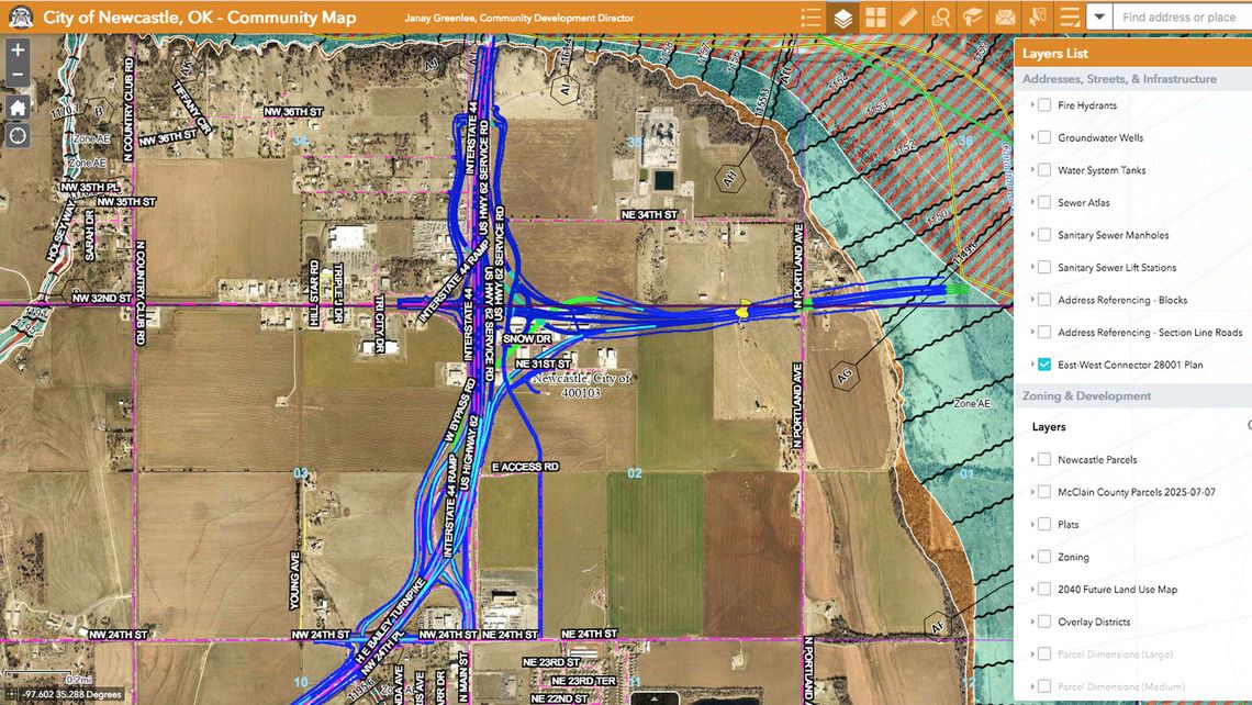
Newcastle City Council took time in their Monday meeting for Mayor Karl Nail to explain that information on the East-to-West Connector turnpike is available on the public works authority’s website.
Nail said there is an interactive map for the City which shows where the turnpike is going to be located, and how the connections will be made at Newcastle.
“This is the most updated map the Oklahoma Turnpike Authority has as to where the connection is at Newcastle,” Nail said.
He said council members have had a lot of questions about where the turnpike is going to be, and these questions are answered on the NPWA website map.
The plans show more of the project than will initially be built, and include the overpass at U.S. Interstate 44, which Nail said will be a divergent diamond interchange like ODOT is building at U.S. Interstate 35 and State Highway 9.
“It’s a lot of information available to the public — probably more information than you will ever need,” Nail said. He added that the map is layered and can be filtered to show water lines and sizes, sewer lines, manholes, and easements that the City has.
“This is great for both citizens who live here and for developers coming to Newcastle,” Nail said. “We have invested a lot of funds to make sure the citizenry is informed.”
Nail said if more information is needed or if someone needs an explanation of what they are looking at, they are welcome to call City Hall and the planning department personnel will be glad to visit.


